Drone Mapping & Digital Twins

Orthomosaic & 3D Digital Twin Drone Mapping can give you better insight into your project in a rapid and safe manner. Map outputs are geometrically corrected and can be used to make accurate direct measurements of distance, angles, volume and area.

PHOTOGRAMMETRYOrthomosaic Mapping

Aerial images captured by our drones undergo a process called Orthorectification which removes the effects of image perspective (tilt) and relief (terrain) for the purpose of creating a correctly scaled map. Orthomosaic maps provide the ability to measure, zoom in and out on key points of interest, identify potential issues, and track progress, all without map distortion. They are a powerful tool across many industries, including real estate, construction, property management, property inspections, and many more.
For mobile phones... To view full screen with Measuring & Navigation Tools, Click EXPAND MAP and tip device to Landscape Orientation.

ADVANCED VISUALIZATION3D Mapping / Digital Twins

Visualizing your project from every angle is now possible using 3D models or "Digital Twins" generated from drone technology. From commercial & residential property to location scouting and utility structure inspections, Digital Twins can capture data and give you a view of your asset that provides greater intelligence, monitoring & risk assessment.
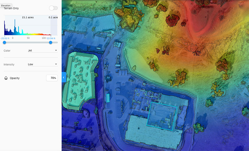
https://elevatedroneops.com/wp-content/uploads/2021/01/Elevation-model-Screenshot2.jpg

DATA ASSETSAerial Data Exports

EDO will consult with you at the start of the project to determine the desired format of your deliverables.

Some of the common data file formats we deliver include:

• OBJ (3D Model)
• GeoTIFF 2D Orthomosaic
• DEM (Digital Elevation Model) - 2D
• LAZ Point Cloud
• JPG Full Size 2D

Assets can also be included into presentations and marketing materials that we can create for you.

AERIAL DRONE FLIGHT SERVICESGet Ready For Your Flight

STEP 1
The first step is to request a FREE quote from us. You can either call us directly or use our online form. You'll need to provide a few general details about what type of drone imagery you need, the location of the subject and when your deliverables are needed.
STEP 2
After receiving your request, we'll go through a pre-flight planning process to review technical aspects of your requested flight. This includes reviewing any airspace restrictions, site logistics, flight time needs and travel requirements. We will get back to you to discuss any further details and present our cost.
STEP 3
From there, we will schedule a flight day and time with you. We also ask for a deposit of 50% of the proposed cost to confirm your flight. Flight dates and times are subject to postponement based on external variables including weather and/or FAA flight restrictions that can arise. See our full refund Cancellation Policy for details.
https://elevatedroneops.com/wp-content/uploads/2020/11/elevate-drone-ops-header-logo-color.png
Elevate Drone Ops provides FAA Part 107 Certified sUAS Drone services in Southern California. Dedicated to safety and fully insured, we produce and deliver aerial imaging and data assets to clients looking to take advantage of the unique visualization benefits of modern drone technology.

CONTACT

Phone:
+1 818.625.9528

eMail:
John@ElevateDroneOps.com

Address:
Calabasas, CA 91302

Copyright © 2023 Elevate Drone Ops - All Rights Reserved